For the past two years, I’ve been working with Technical Services on the Frank Baker Collection of British Methodism and Wesleyana. Baker, a religion professor at Duke, was the preeminent scholar on the foundations of Methodism, specifically its founder, John Wesley. The collection is vast: it contains research for Baker’s many books and articles, original Wesleyan and Methodist documents from the 18th and 19th centuries, teaching materials, correspondence with other prominent religious minds, and a variety of items that simply fit no category.
Perhaps the most interesting part of working with the Frank Baker collection is this treasure trove of miscellany collected by Baker throughout the years. Though primarily a Wesleyan scholar, Frank Baker had a penchant for all religious historical materials, and his collection is frequently peppered with unidentifiable portraits, letters, and notes relating to religion.
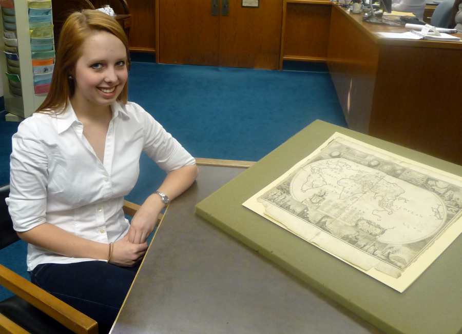
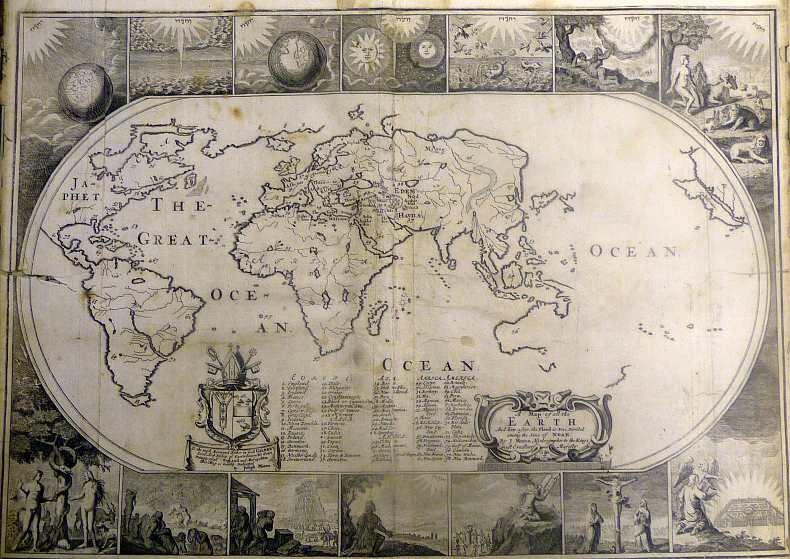
One such enigmatic finding was a folded, faded map that, at first, appeared rather unimpressive. Tucked away in a box of other large maps, our subject was folded, torn, and in pretty bad shape. Once unfolded, however, I was instantly drawn to it.

Self-titled, the map reads: “A Map of all the Earth And how after the Flood it was Divided among the Sons of Noah.” Though faded, brittle, and torn, the value of this map is instantly obvious. From the fascinating religious motifs around the sides (some familiar, some indecipherable), to the labeling of each continent with a son’s name, the map certainly sucks you in.

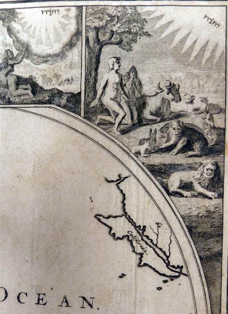
Some of my favorite parts of this map aren’t readily obvious, either. For example, take a good look at the West Coast of the United States. It’s subtle, but California is depicted as an island! It was actually this feature that helped me to date the map. With a little research as to when the name California came into usage, I discovered that our finding probably dates to the 1680s or 1690s. A little more research revealed that California was often depicted as an island in the 16th and 17th centuries: I even found a whole book full of maps with this cartographic error!

As a religion minor, I often found myself returning to the stunning religious motifs decorating the borders of this map. Some are familiar scenes, like Adam and Eve in the Garden of Eden, the Tower of Babel, the Crucifixion, etc. Others are less familiar, such as a shining city as viewed from a hill, or an unidentified man kneeling next to a tree.
I could spend hours trying to figure out the motivations behind the map, or its motifs, or why Japhet, son of Noah, got all of North America, but there’s many more mysteries to find and catalog in the Frank Baker Papers!
Post contributed by Chloe Rockow, a junior majoring in Public Policy Studies with a double minor in Religion and Political Science.


One thought on “A Hidden Map”
Comments are closed.