
Interactive Maps of China
China Data Center Map (Click to Explore)
Explore a fully interactive map (click “Historical Collection”) of Gamble’s sojourns created by the China Data Center at University of Michigan and Wuhan University

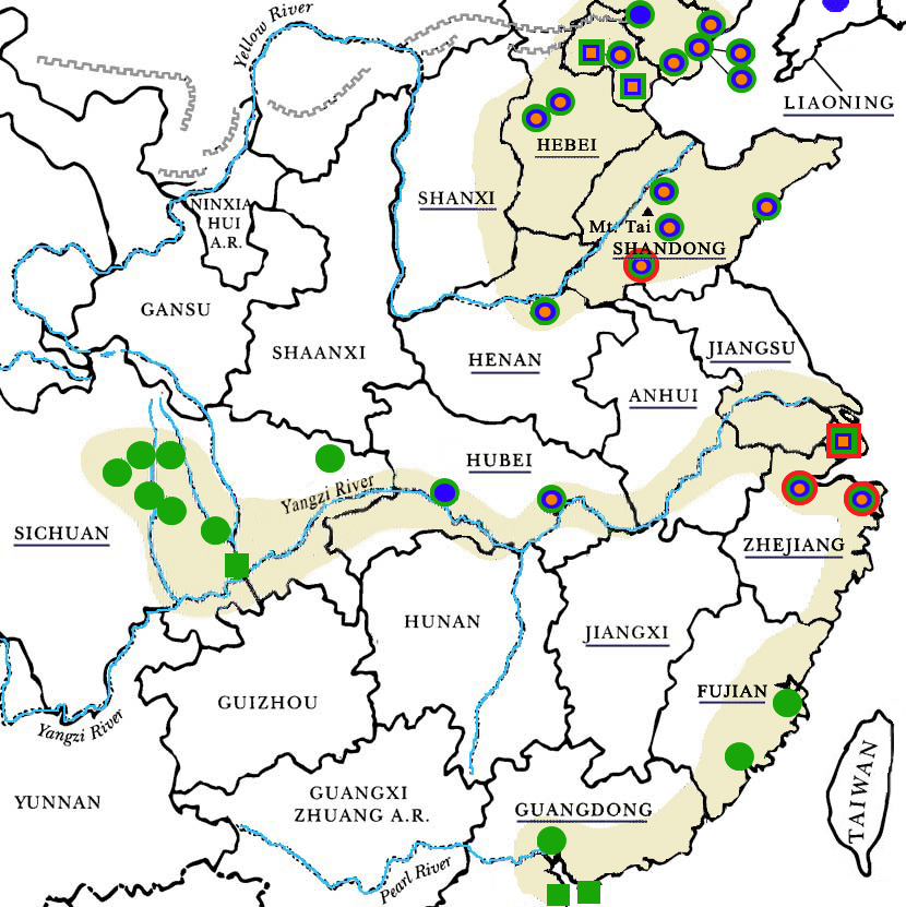
Clickable Map
Click on a dot or province name to browse photographs taken by Sidney D. Gamble at that location. When your mouse pointer hovers over a dot, the location name should appear. There are some provinces in which no photographs were taken.
Color Key
The colors used for the different locations represent the various journeys that Gamble made to China:
1908: ![]() | 1917-1919:
| 1917-1919: ![]() | 1924-1927:
| 1924-1927: ![]() | 1931-1932:
| 1931-1932: ![]()
The 1908 photographs will be digitized and uploaded as part of future additions to the site
Map copyright by China Institute, used with permission.